
Happy GIS Week!
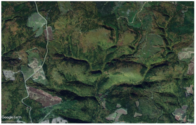
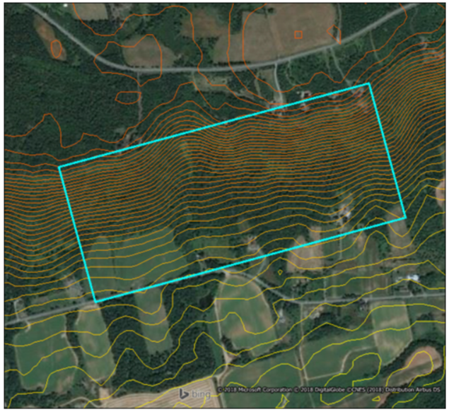
We were working recently on an assignment in the Annapolis Valley, the land of orchards and sloping vineyards…and that got us thinking about the impact of elevation on land area. Ultimately, the question is one of land value: inherent in the value of agricultural land is potential crop yield. More land area equals more growing potential equals more value. Where slopes are acceptable or even advantageous, they may serve double duty in that sloped land is larger than it seems.
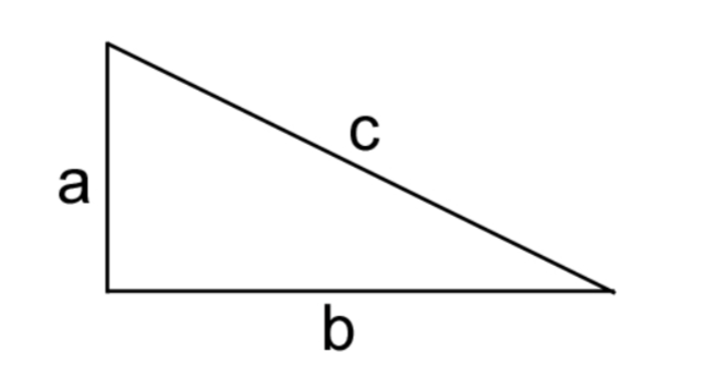
Our Valuation Division’s MO is to maximise your property value…this is an Economic Intelligence Unit blog post, and this is GIS Week, so we’re going to geek out on how to ensure you’re counting all your land, using a GIS, a little high school math, and a fair bit of Pythagoras[i].
Pythagoras’ Theorem defines the relationship between the sides of a right triangle with the equation a² + b² = c². Side “c” is the hypotenuse, and is always the longest of the three sides.
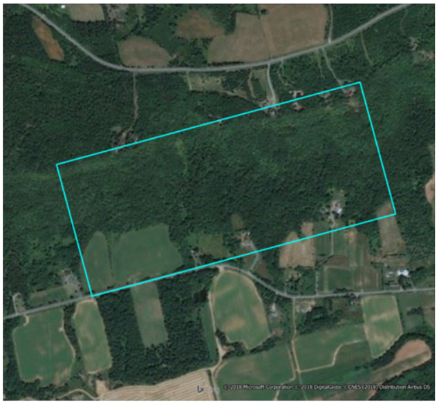
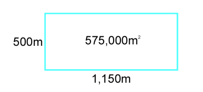
For illustrative purposes, we created a convenient, perfectly rectangular, parcel. It measures 500 x 1,150 m, for a total area of 575,000 m² (57.5 hectares).
That is:
But the land comprising this parcel is sloped. The contour lines added to the image below demonstrate the degree of the slope; on average, there is an elevation differential between the highest and lowest elevations of 140 m.
Thus, the 500 m parcel dimension is effectively 519.2 m:
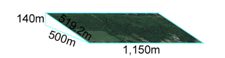
and the effective land area is 597,080 m² (59.7 ha.), a difference of 22,080 m² – over 2 hectares of extra space for crops!
This is a highly simplified example of the impact of slope on land area. There are many other factors to take into account, such as the tipping point between beneficial slopes and unusable inclines. But in a world where “land: they’re not making any more of it,” holds true, the most informed decisions are the best ones. Where a precise figure is required, you’ll need to call in a professional land surveyor. But when an area scaled from a map is fit for purpose, using a GIS and a little high school math can yield a more useful number than you’d get from a regular map.
P.S. a related fun fact was shared at Wednesday night’s Geomatics on the Town event (part of the 2018 Geomatics Atlantic Conference): tree planters space their seedlings at a certain distance from each other. For one tree planter, this was the equivalent of 3 steps on flat ground, but on sloped terrain, it was 12 steps in order to leave sufficient room between trees!
[i] Mainly for defining the relationship between the sides of a right triangle, but a little bit for first floating the idea that the Earth is a sphere…it comes into play in measuring distance. There are two methods of measurement in a GIS, Cartesian and Spherical. The Cartesian method calculates distance and areas based on data as projected onto a flat surface (like scaling from a paper map), while the Spherical method accounts for the curved surface of the Earth (like scaling on a globe). The distances in this example were measured in MapInfo using the Spherical method.

Alex Baird Allen is the Manager of Turner Drake’s Economic Intelligence Unit, and has a high level of expertise and interest in GIS. If you’d like to reach Alex, call 902-429-1811 Ext.323 (HRM), 1-800-567-3033 (toll free), or email