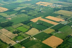
The valuation of agricultural property requires much more than a review of the real estate asset. External supply and demand factors for the agricultural product influence property values. Many agricultural properties are subject to supply management through a government mandated quota system. In addition, the value of the real estate is also a function of demand in the food commodity markets. Our Valuation Team includes a team leader who specialises in agricultural and other rural property. The types of rural assignment we undertake include the following:

In order to meet the constraints (weather, accessibility, cost, heterogeneous sales data) implicit in many types of rural assignments and to ensure that the value is accurate, our Valuation Division has developed specialist methodologies for inspecting and valuing agricultural property. In so doing we have relied heavily on the use of our Geographic Information System (GIS) and our CompuVal® information technology platform. Farm inspections are particularly challenging because they require the acquisition of information on so many diverse components: farm dwellings, farm buildings, timber and vegetation cover, farm land utilisation, area, soil type, texture, structure, consistence, fertility (crop yield), colour, pH, stoniness, topography, drainage, Land Use Capability (for crops), etc. To undertake the inspection efficiently we have developed a survey instrument that captures these “critical to value” characteristics, and records each attribute on a field by field basis. Using our GIS we are able to produce high definition aerial or satellite site inspection maps rendered with the boundaries, topography, land cover (arable, homestead, poorly drained, swamp, soil classification, Canada Land Inventory), to aid in the inspection process.
Although we now acquire the raw data (location, sale price, purchaser’s name) in bulk from provincial sources and process it into usable form using proprietary algorithms, detailed information on the sales of comparable properties, on which the accuracy of the valuation process depends, has to be generated from a variety of sources. Using our GIS system and a property inspection we can overlay terrain attributes (such as soil type) over a site map for each comparable property to compute the area of the attribute. We utilise high definition, three dimensional aerial and satellite imagery to gather information on buildings located on these properties. Because rural properties are heterogeneous, and include many attributes, each of which contributes to the property’s value, the “standard” appraisal technique of analysing the sale price on a “per acre” basis and then “adjusting” for the difference between it and the property being valued, frequently fails to produce a reliable and accurate result. Our proprietary software, part of our CompuVal® IT system, therefore uses the attribute information to disaggregate the sale prices on a “component” basis. We utilise this “component” value information, gathered from comparable property sale transactions, as building blocks to value the subject property and to identify opportunities for liberating value.